


FindEveryBeach


The Bloomfield Track, or as the locals call it 'The Coast Road'
The Bloomfield Track is a 37km long gravel 4wd track with numerous creek crossings that takes you on a journey through ancient rainforest, crosses high mountain passes and drops you down to pristine coastline.
Map
I wanted to share with you a map showing the track, but was unable to find one that showed what I wanted, so I created my own map. Quite proud of myself !!
The Bloomfield Track is the portion of road between Emmagen Creek at the southern end and Wujal Wujal at its northern end.
I used Gaia GPS to create this map: www.gaiagps.com
Gaia GPS is one of the mapping apps I use for offline map tracking and route planning.

Links to
information sources about the track
https://www.tropicalnorthqueensland.org.au/listing/itinerary/bloomfield-track/
https://www.destinationdaintree.com/locations/the-bloomfield-track
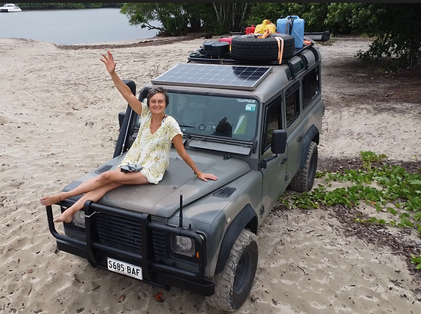
I drove the Bloomfield Track for the 1st time last year on my trip up to the tip of Aussie via the Telegraph Track with my friend Dean.
Since then I have returned to the area to live, work and experience life in Wujal Wujal, an aboriginal community, situated on the Bloomfield River, at the northern end of the track.
During my 5 months in Wujal Wujal, the track became my primary route south to Mossman where I would "do a real grocery shop" - a 3 hour trip from Wujal Wujal to Mossman.
As a result of living in the area, I have driven the track numerous times and this imagery is from those numerous experiences.
This has also influenced my opinions about which vehicles should really not drive the track as I have experienced the track being closed numerous times by jack-knifed / rolled caravans!
Rainforest covered mountains an stunning remote coastlines are visible from this mountain pass on a blue sky day. Be prepared however to find yourself in the clouds more often than not, this is a rainforest after all.

I love driving this track.
I love being in the rainforest, driving up and over the large mountain ranges and the moments when you pop back down to the remote coast and its pristine beaches.
The little creeks/rivers flowing out of the dense rainforest always draw my eye.
They look like secret access trails into the rainforest, especially in the dry season when the creek beds are dry, when they appear to be a path into the seemingly endless forest.
On one of my many trips along this track I set out to follow one of these dry creeks towards the ocean and actually discovered to my surprise there was actually a well-hidden 4x4 track next to the creek, a track that I had never noticed before. I enjoyed exploring this track which opened out onto a pristine remote sandy beach lined with coconut palms and with pig footprints in the sand.
Click here to unmute
This clip below shows the the little side 4x4 track led to....
Click here to unmute
I love knowing that most of the rainforest is inaccessible and knowing that as a result of that the wildlife that lives here is relatively safe from human intervention.
I also love the moments when my journey through the forest coincides with an encounter with some of that wildlife.

Early mornings seem to be the best time to encounter Cassowary who will often wander
down the middle of the road!
I include clips of these Cassowary in the video at the end of this page.

I also treasured the moment when I saw a large white lipped tree frog perched above the swimming hole at Emmagen Creek, ignoring the raucous laughter of a group of tourists splashing and frolicking in the water below it.
Along the track there are numerous small dirt tracks that disappear off into the forest, some of these only go a few metres, but others wander through to hidden clearings. After rain many of these tracks can be quire muddy, so be careful if you drive off along one of these trails as with no cell cover and no one able to see you, you could be stuck a long while!
Why is it a rainforest and not a jungle?
A jungle is an area that’s densely overgrown with trees and tangled vegetation, usually in a warm place with a high rainfall. Their floors are thick with vines, shrubbery, and tons and tons of insects, making it super difficult to make your way through one.
A rainforest, like a jungle, is filled with thick vegetation—but unlike a jungle, it has a layer of tall trees, called a canopy, that blocks out most of the sunlight. This canopy prevents light from reaching the ground, inhibiting the growth of plants on the forest floor. So while jungles have a ton of stuff happening below your feet, rainforests don’t—most of the action is happening in the trees above.

After rain is it also not uncommon for trees to fall over the road, on my trips through the road I only had to tow a tree off the road once, with the other instances being smaller trees I was able to drive around.
Emmagen Creek swimming hole
This very scenic swimming hole is a destination all on its own and is well worth the time is takes to walk to it from the road, a walk that takes me just over 5 mins. There are few tracks into the rain forest and this track provides you with an opportunity to experience the rainforest first-hand.

The trail to the swimming hole is NOT mobility access friendly as it has exposed roots, puddles and occasionally muddy.
But don't let this put you off, it is well worth it.
Take your swim suit with you, otherwise you may find yourself compelled to go swimming even if you don't have them with you, as I was on one occasion
Swimming with the fish
One of the things I enjoy the most about swimming at Emmagen Creek are the fish that are not startled off by swimmers and continue to swim in the main swimming hole even if you are swimming there, they continued to swim around my legs as I stood in the water with them.

My other favourite swimming hole on the track
Near the northern end of the track is Wukuku Creek which flows under a curved stone/concrete bridge and it is my other favourite swimming hole. I show it in my video clip at the end of this page.
Lizards
There are obviously a lot of lizards living in the rainforest, so seeing one on your journey through the track, if you are looking, is quite likely. Here are images of some I have encountered.


The Bloomfield River and Bloomfield Falls
The northern end of the track ends at Wujal Wujal, an aboriginal community situated on the northern side of the Bloomfield River. The community has an art centre & cafe which you will drive past en route to the falls open during regular business hours. There is also boutique accommodation available in town but you need to book it through the council during regular office hours (at time of writing this). The community welcomes visitors so take your time here, rather than rushing through.
I recommend contacting local elders through the Wujal Wujal Aboriginal Shire Council to undergo a ‘welcome to country’ (smoke) ceremony before you access the falls.
Your journey up the track is not complete without stopping at the Bloomfield Falls.
Video showing my experience of The Bloomfield Track
Click here to unmute
Living the Dream
Sharing the Journey
Wow! It's a wonderland. We LOVE following your intrepid tracks and poring over your pictures and videos Please keep posting.
Wondered where you'd got to! Are you living up at Wudjul Wudjul for a bit? Green with envy, what an amazing place.
Looks amazing Tania!
Ever the adventuress.
xx